ROS Resources: Documentation | Support | Discussion Forum | Index | Service Status | ros @ Robotics Stack Exchange
Ask Your Question
0

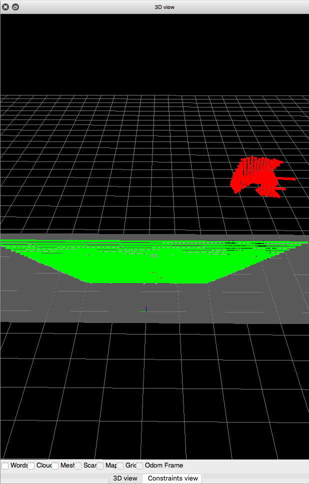
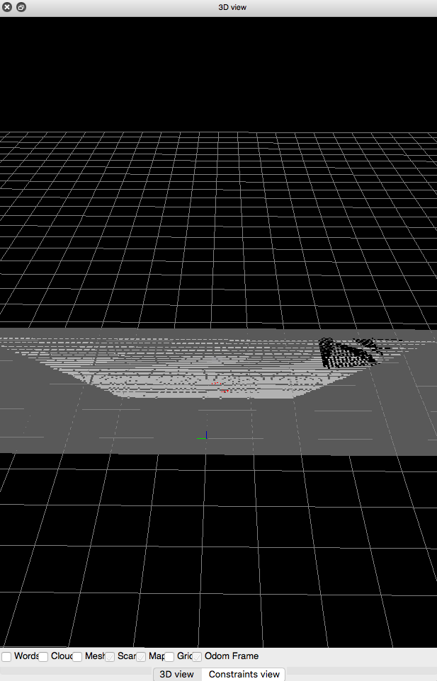
Costmap shows free space as obstacles

asked 2018-05-18 03:29:49 -0500

Fedor gravatar image

Hi everyone! I am trying to use navigation stack on quadcopter equipped with kinect sensor at Gazebo simulation. I am using grid_map topic of rtabmap_ros package as map for navigation of UAV which hovers at 1.5 m over ground. But global_costmap and local_costmap both show free space on proj_map as obstacles (proj_map, global_costmap). How can I fix it?

Costmap common params:

footprint: [[-0.2,-0.2],[-0.2,0.2], [0.2, 0.2], [0.2,-0.2]]
inflation_radius: 0.65
cost_scaling_factor: 10.0

obstacle_layer:
  obstacle_range: 5.5
  raytrace_range: 6.0
  max_obstacle_height: 0.7
  track_unknown_space: true

  observation_sources: point_cloud_sensor
  point_cloud_sensor: {
    sensor_frame: quad/camera__link,
    data_type: PointCloud2,
    topic: /quad/camera_/depth/points,
    marking: true,
    clearing: true
  }

Global costmap params:

global_costmap:
  global_frame: /map
  robot_base_frame: /base_link
  update_frequency: 1.0
  publish_frequency: 1.0
  static_map: false
  plugins:
     - {name: obstacle_layer, type: "costmap_2d::ObstacleLayer"}

Local costmap params:

local_costmap:
  global_frame: /map
  robot_base_frame: /base_link
  update_frequency: 5.0
  publish_frequency: 2.0
  static_map: false
  rolling_window: true
  width: 5.0
  height: 5.0
  resolution: 0.02
  tranform_tolerance: 0.5
  planner_frequency: 1.0
  planner_patiente: 5.0
  plugins:
     - {name: obstacle_layer, type: "costmap_2d::ObstacleLayer"}
edit retag flag offensive close merge delete

Comments

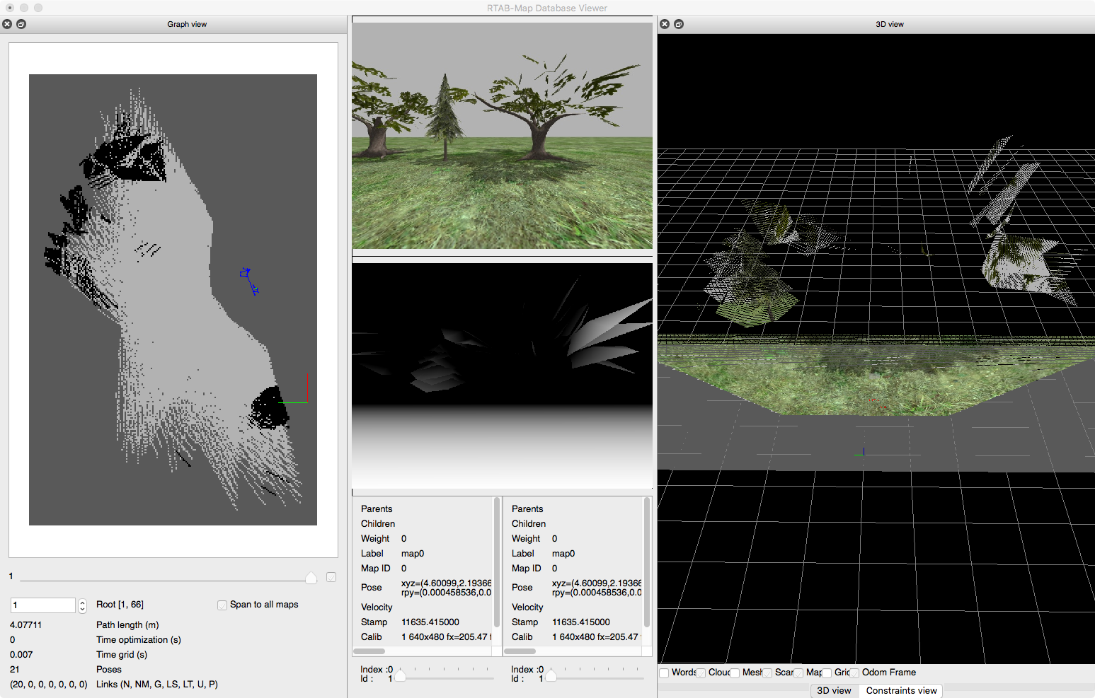
Can you show a screenshot of the Gazebo environment? Can you share the rtabmap.db too?

matlabbe gravatar image matlabbe  ( 2018-05-18 09:17:12 -0500 )edit
Fedor gravatar image Fedor  ( 2018-05-20 03:09:00 -0500 )edit

1 Answer

Sort by ยป oldest newest most voted
1

answered 2018-05-20 11:58:04 -0500

matlabbe gravatar image

updated 2018-05-21 09:34:20 -0500

From the database you shared, the depth image seems strange because the trees are mostly big polygons with texture. But with this input data, the occupancy grid is generated correctly though.

Using rtabmap-databaseViewer, raw point cloud with RGB+depth image (on left all local occupancy grids assembled) :

image description

3D Segmentation based on Grid/ parameters (note that as Grid/RangeMax is 4 meters, the cloud is cut up to 4 meters):

image description

Then the projected 2D grid for this image:

image description

EDIT

In your obstacle_layer, you take the whole point cloud of /quad/camera_/depth/points as obstacle, including the ground. It is why the ground is seen as an obstacle in the costmap. You may use a filtered cloud from /quad/camera_/depth/points without the ground instead. If the drone is flying always at the same height, it would not be so difficult to filter the ground (like with a pcl_ros passthrough). In contrast to this example with a ground robot, if the drone is moving also in Z and/or the ground is not flat, you may want to keep the ground as obstacle and use the 3D map/OctoMap output of rtabmap for 3D navigation (with moveit?).

For the Grid/RangeMax parameter, if you have an older rtabmap version, the parameter is called Grid/DepthMax (Grid/DepthMax is automatically converted to Grid/RangeMax if the version supports it). To have more points to project at longer distance, you can also set Grid/DepthDecimation to 1 (default 4) at the cost of more computation time.

cheers,
Mathieu

edit flag offensive delete link more

Comments

Thank you for answer. So, my issue is related to costmaps: global and local costmaps show free space at grid_map as obstacles. Costmaps blink (pic1, pic2, pic3), though grid_map remains the same. What may be the problem?

Fedor gravatar image Fedor  ( 2018-05-21 02:07:57 -0500 )edit

I deleted parameter Vis/MaxDepth and added Grid/RangeMax with a value of 9, but cloud is still being cut up to 4 meters. Changing Grid/RangeMax to 2 doesn't change cut up distance.

Fedor gravatar image Fedor  ( 2018-05-21 02:14:18 -0500 )edit

Neither Grid/MaxDepth nor Grid/RangeMax haven't changed cut up distance - maybe problem somewhere else. I have added rtabmap_ros/obstacles_detection nodelet and have changed point cloud source in costmaps to /cloud_obstacles topic. It has fixed my problem, thanks for your help!

Fedor gravatar image Fedor  ( 2018-05-22 07:28:46 -0500 )edit

Question Tools

2 followers

Stats

Asked: 2018-05-18 03:29:49 -0500

Seen: 1,273 times

Last updated: May 21 '18