
RTABmap obstacles_detection node does not mark obstacles

Hi,
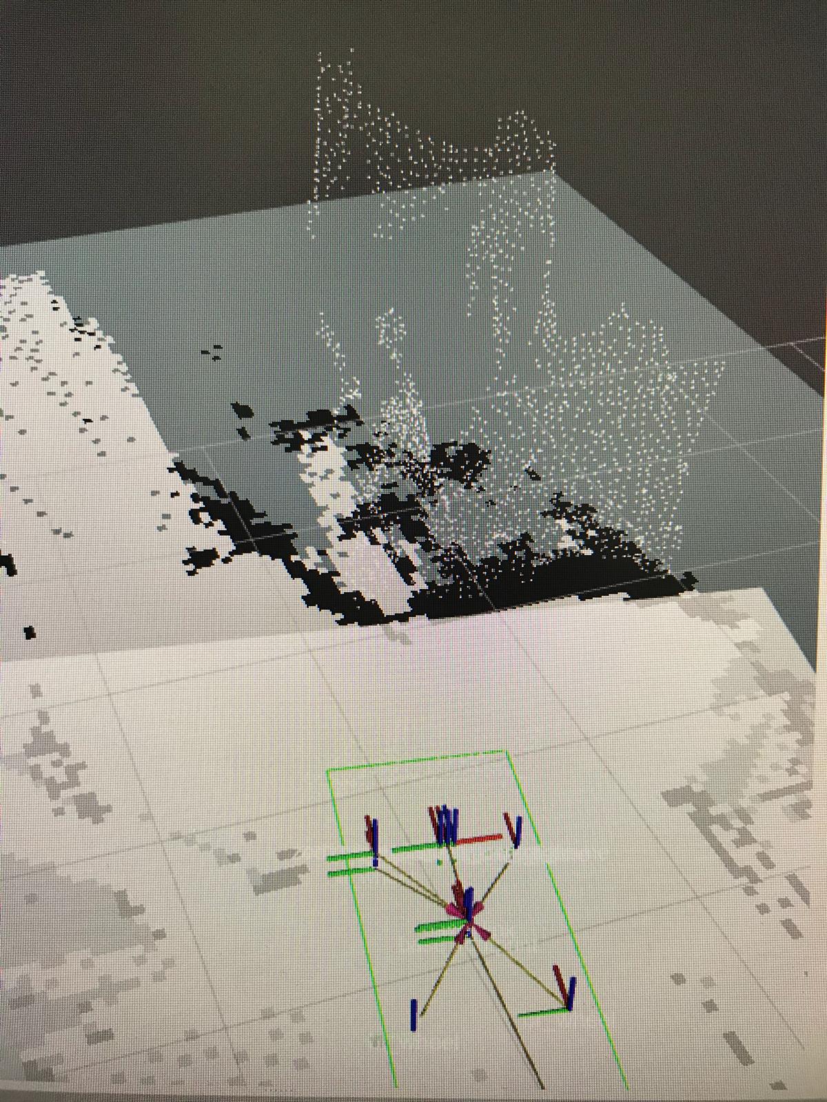
I want to make the rtabmap obstacles_detection node to mark and clear the obstacles on local_costmap however I cannot see that on my local_costmap RViz (even though the obstacles cloud is clearly visible):
Here is my local_costmap config:
local_costmap:
  global_frame: odom
  robot_base_frame: base_footprint
  update_frequency: 2.0
  publish_frequency: 2.0
  transform_tolerance: 5 # 0.25 seconds of latency, if greater than this, planner will stop
  static_map: false
  rolling_window: true # Follow robot while navigating
  width: 4.0
  height: 4.0
  origin_x: -5 #-1.5
  origin_y: -5 #-1.5
  resolution: 0.03
  map_type: costmap

  plugins:
#  - {name: static_layer, type: "costmap_2d::StaticLayer"}
   - {name: obstacle_layer, type: "costmap_2d::ObstacleLayer"}
   - {name: inflation_layer, type: "costmap_2d::InflationLayer"}

  obstacle_layer:
    obstacle_range: 0.6
    raytrace_range: 0.6
    max_obstacle_height: 0.4
    track_unknown_space: true
    observation_sources: radar_sensorA point_cloud_sensor point_cloud_sensorB

  # assuming receiving a cloud from rtabmap_ros/obstacles_detection node
    radar_sensorA: {
      data_type: LaserScan,
      topic: /scan,
      expected_update_rate: 0.5,
      marking: true,
      clearing: true}

    point_cloud_sensor: {
      sensor_frame: base_footprint,
      data_type: PointCloud2,
      topic: /planner_cloud,
      expected_update_rate: 1.0,
      marking: true,
      clearing: true,
      min_obstacle_height: 0.04,
      max_obstacle_height: 99999.0}

    point_cloud_sensorB: {
      sensor_frame: base_footprint,
      data_type: PointCloud2,
      topic: /ground,
      expected_update_rate: 1.0,
      marking: true,
      clearing: true,
      min_obstacle_height: -1.0}
What could be the reason?
Also, what if I will use pointcloud_to_laserscan package and use the laser scan as an obstacle detector?

what is your
rqt_graph? are topics correctly linked to move_base? It is also possible to use pointcloud_to_laserscan, which can save you some computation time, though less safe if you need to track 3D obstacles.