ROS Resources: Documentation | Support | Discussion Forum | Index | Service Status | ros @ Robotics Stack Exchange
Ask Your Question
0

Fantom data in laserscan output

asked 2021-09-16 09:36:57 -0500

sisko gravatar image

updated 2021-09-16 09:39:14 -0500

I have a problem with my laser scanners publishing corrupt data. I am using the laser merge package to combine the readings of 2 lasers into a single topic. In gazebo and with the robot nowhere near obstacles, there is a single entry in the scans topic which has data suggesting it is detecting an obstacle, pictured below :

image description

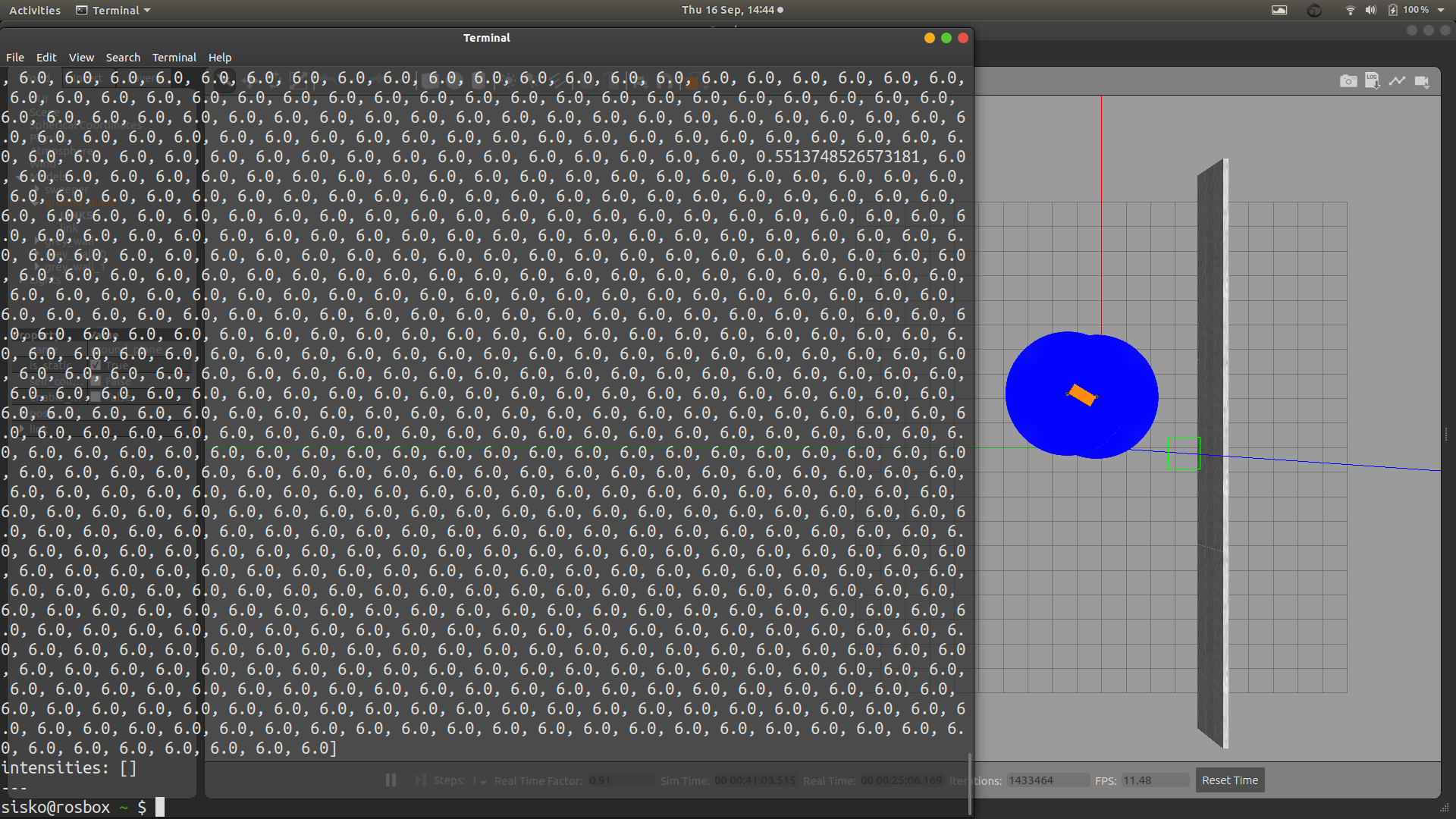
The picture above has a wall but the range of the lasers fall short of the wall. Even in open space further from the wall or without the wall, I still get the single occurance of data. That single occurance is causing issues with my code.

Can anyone help ?

edit retag flag offensive close merge delete

Comments

1

Does the scan before merging detect the obstacles? ( I think the starting point is to isolate whether the simulated scan is not working or the merge is not working )

miura gravatar image miura  ( 2021-09-16 18:23:15 -0500 )edit

1 Answer

Sort by ยป oldest newest most voted
0

answered 2021-09-17 07:30:41 -0500

osilva gravatar image

updated 2021-09-17 07:37:50 -0500

Hi @sisko In this paper talks about the limitations with merger:

https://arxiv.org/pdf/1411.1086.pdf

"The generation of the merged laser scan follows an initial phase in which all the laser scans to be merged are flattened to a single plane, which is the scanning plane of the destination (merged) laser scan. As a consequence, objects that would not be observable in the destination (merged) laser scan, but that are in some of the input scans, will (wrongly) appear in the final merged scan"

So you might need to process the data, and decide how probable there is an obstacle, maybe, use 5 sampling before making a decision.

edit flag offensive delete link more

Comments

There is a very interesting paper on the subject:

https://www.ncbi.nlm.nih.gov/pmc/arti...

Source: Environment Mapping Using Sensor Fusion of 2D Laser Scanner and 3D Ultrasonic Sensor for a Real Mobile Robot

Take a look at this package: http://wiki.ros.org/octomap

osilva gravatar image osilva  ( 2021-09-17 08:09:06 -0500 )edit

Question Tools

3 followers

Stats

Asked: 2021-09-16 09:36:57 -0500

Seen: 68 times

Last updated: Sep 17 '21