
Spatial_temporal_voxel_layer not being populated

Greetings , I am trying to setup the tutorial of Spatial Temporal Voxel Layer (STVL) from the offical website on ROS Foxy (installed using debs), Ubuntu 20.04. STVL is compiled from source (foxy-devel branch).
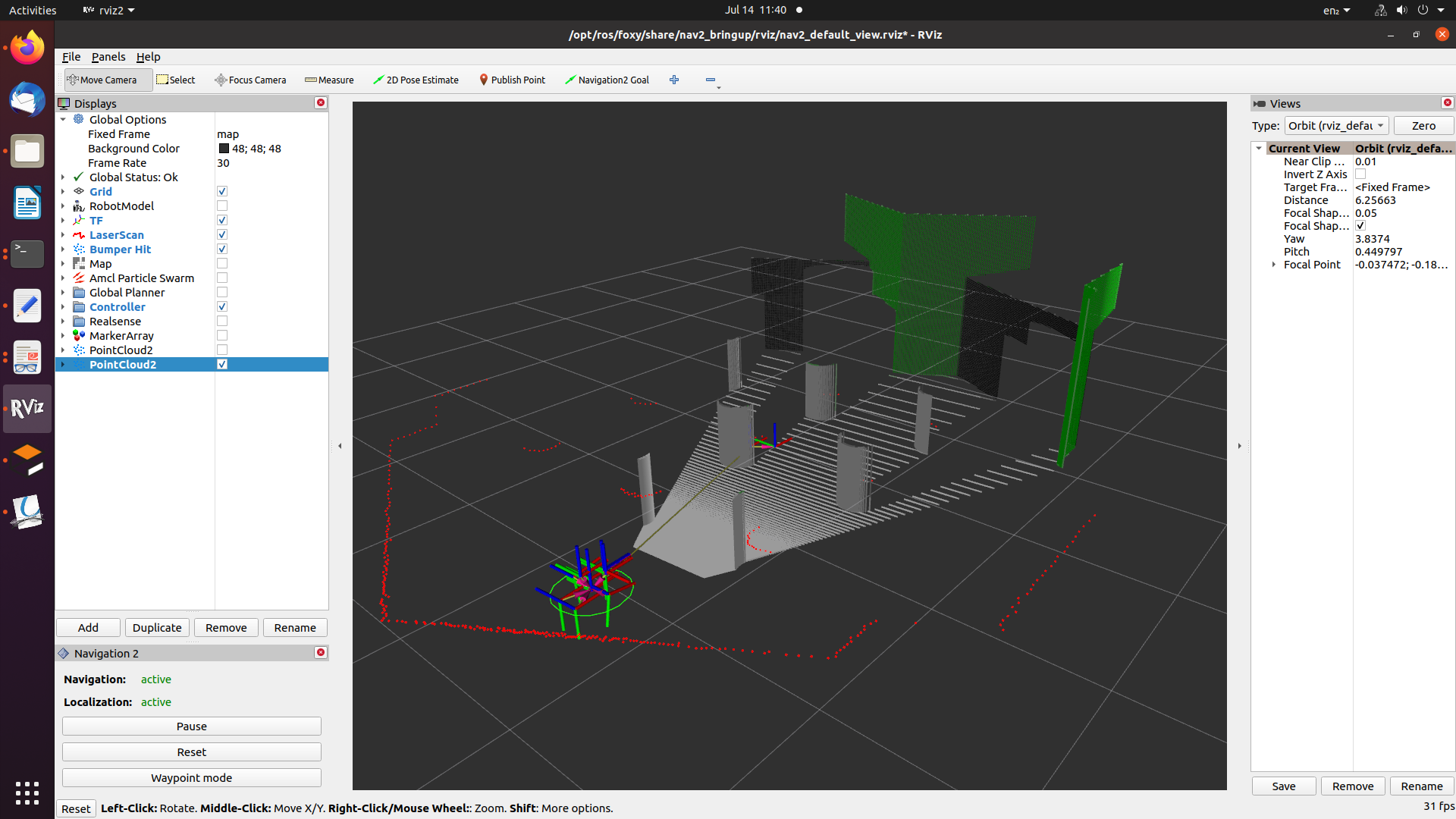
The costmap layer is not creating any obstacles based on the points read from the sensor. The following msgs are displayed on the console:
[controller_server-2] [WARN] [1626235911.078158591] [local_costmap.local_costmap]: intel_realsense_r200_depth/points buffer updated in 51.86s, it should be updated every 0.00s.
[controller_server-2] [WARN] [1626235911.078251423] [local_costmap.local_costmap]: intel_realsense_r200_depth/points buffer updated in 51.86s, it should be updated every 0.00s.
[planner_server-3] [WARN] [1626235911.085046724] [global_costmap.global_costmap]: intel_realsense_r200_depth/points buffer updated in 51.86s, it should be updated every 0.00s.
[planner_server-3] [WARN] [1626235911.085151591] [global_costmap.global_costmap]: intel_realsense_r200_depth/points buffer updated in 51.86s, it should be updated every 0.00s.
The params are as follows:
global_costmap:
  global_costmap:
    ros__parameters:
      use_sim_time: True
      footprint_padding: 0.03
      update_frequency: 1.0
      publish_frequency: 1.0
      origin_x: -5.0 # Otherwise the robot is lying outside the costmap
      origin_y: -5.0
      global_frame: map
      robot_base_frame: base_link
      robot_radius: 0.22 # radius set and used, so no footprint points
      resolution: 0.05
      width: 10
      height: 10
      plugins: ["inflation_layer", "vlp16_stv_layer", "static_layer"] #
      vlp16_stv_layer:
        plugin: "spatio_temporal_voxel_layer/SpatioTemporalVoxelLayer"
        enabled:                  true
        voxel_decay:              1.0  # seconds if linear, e^n if exponential
        decay_model:              0     # 0=linear, 1=exponential, -1=persistent
        voxel_size:               0.05  # meters
        track_unknown_space:      true  # default space is known
        max_obstacle_height:      2.5   # meters
        unknown_threshold:        15    # voxel height
        mark_threshold:           0     # voxel height
        update_footprint_enabled: true
        combination_method:       1     # 1=max, 0=override
        obstacle_range:           5.0   # meters
        origin_z:                 0.0   # meters
        publish_voxel_map:        false # default off
        transform_tolerance:      1.0   # seconds
        mapping_mode:             false # default off, saves map not for navigation
        map_save_duration:        60.0  # default 60s, how often to autosave
        observation_sources:      realsense
        realsense:
          data_type: PointCloud2
          topic: intel_realsense_r200_depth/points
          marking: true
          clearing: true
          min_obstacle_height: 0.2     # default 0, meters
          max_obstacle_height: 2.5     # default 3, meters
          expected_update_rate: 1.0    # default 0, if not updating at this rate at least, remove from buffer
          observation_persistence: 0.0 # default 0, use all measurements taken during now-value, 0=latest
          inf_is_valid: false          # default false, for laser scans
          voxel_filter: false          # default off, apply voxel filter to sensor, recommend on
          clear_after_reading: true    # default false, clear the buffer after the layer gets readings from it
      inflation_layer:
       plugin: "nav2_costmap_2d::InflationLayer"
       enabled: true
       inflation_radius: 0.55
       cost_scaling_factor: 1.0
       inflate_unknown: false
       inflate_around_unknown: true
      static_layer:
        plugin: "nav2_costmap_2d::StaticLayer"
        map_subscribe_transient_local: True
      always_send_full_costmap: True
I am using identical params for local-costmap.
I am able to run simulation with 2D LiDAR but not with Realsense sensor.
EDIT 1: The echo of topic 'intel_realsense_r200_depth/points' is as follows:
header:
  stamp:
    sec: 32
    nanosec: 600000000
  frame_id: camera_depth_frame
height: 1
width: 76800
fields: '<sequence type: sensor_msgs/msg/PointField, length: 4>'
is_bigendian: false
point_step: 32
row_step: 2457600
data: '<sequence type: uint8, length: 2457600>'
is_dense: false
 Given that height is read as 1, is sensor data correctly being published?
Am I missing something in settings? Thanks
add a comment
