
Road elevation issue of using opendrive map in the ASSURE mapping tool
Hi all,
I am trying to use the ASSURE mapping tool to load a opendrive format map to convert it into a lanelet2 format map. After loading the opendrive map, the elevation of roads are not changing continuously but "stepwise" as below:
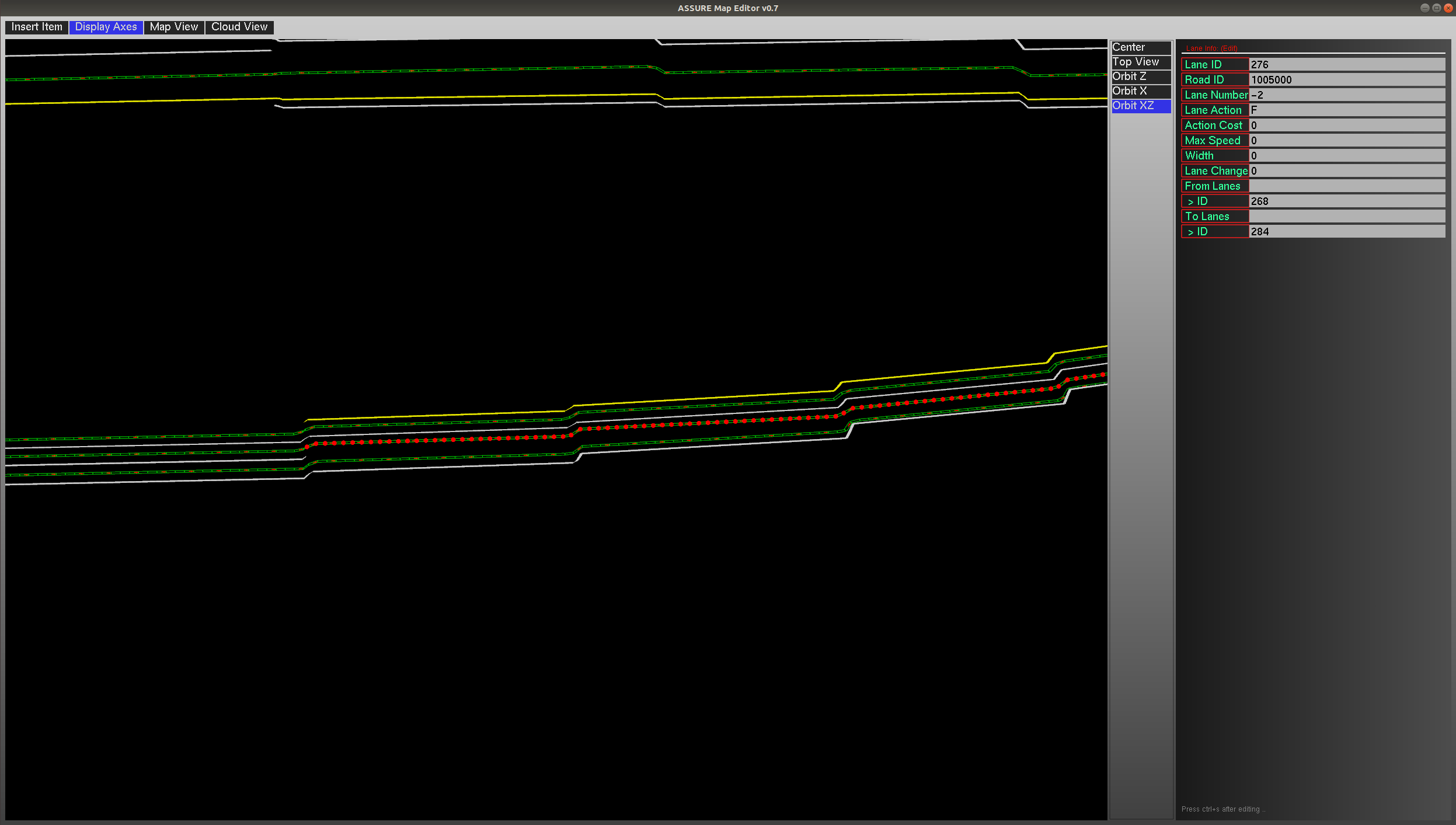
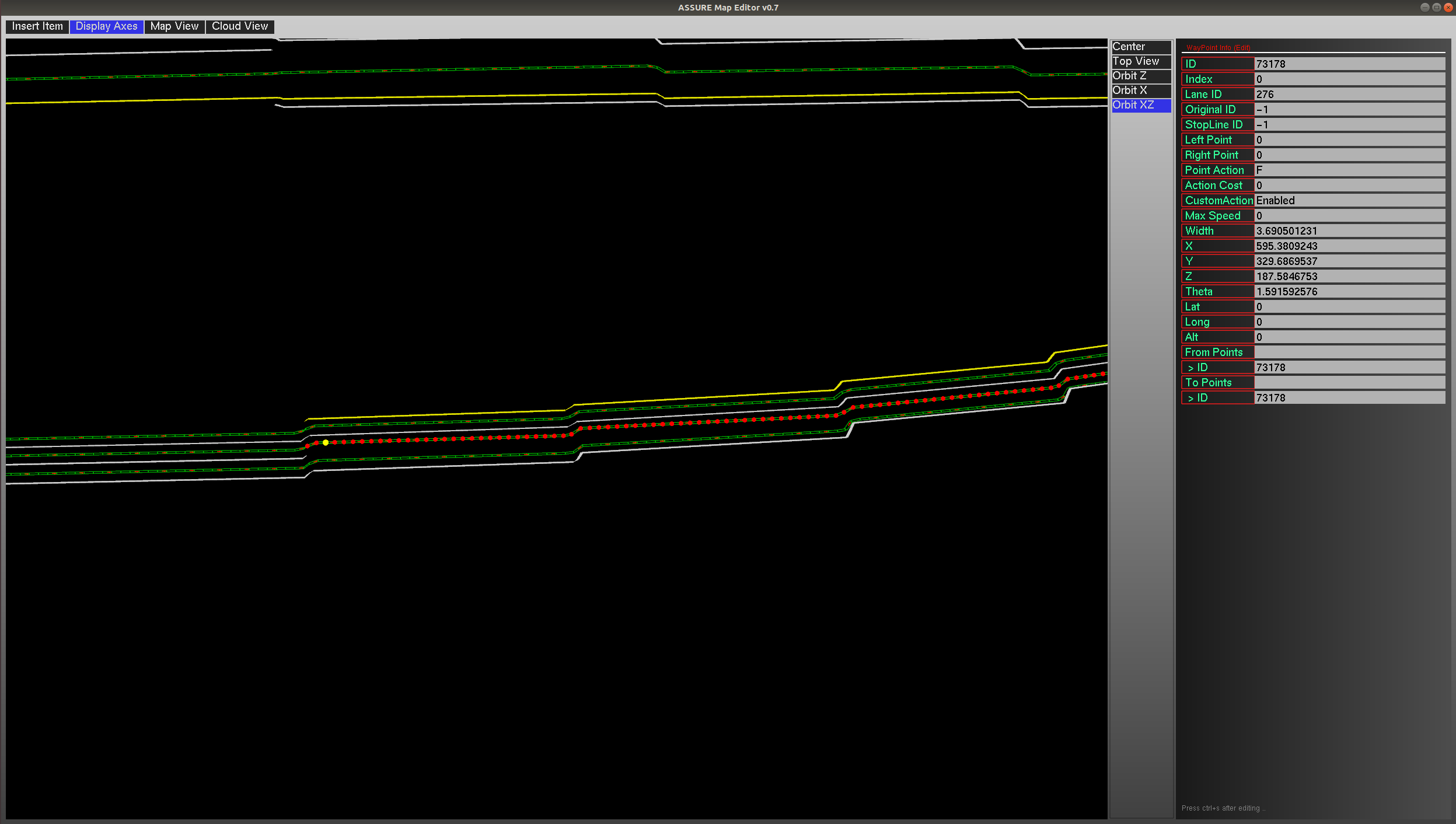
The screenshots of two specific points information are as below (it can be found they share a same z value):

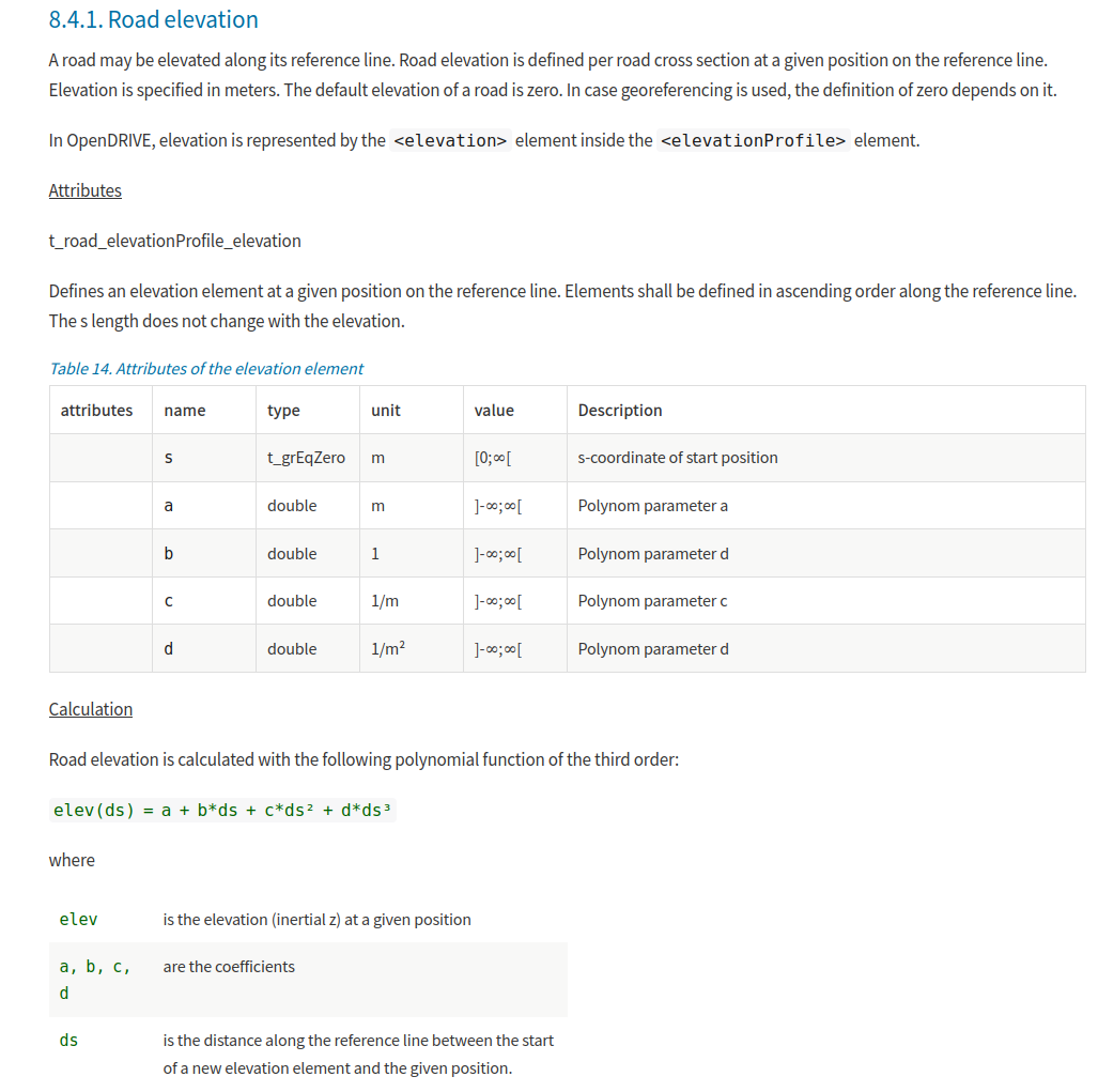
From the opendrive map introduction, the elevation is calculated based on the following equation:
After checking the original file of the opendrive map, it seems the coefficients of the road are correctly given. So I expect the road elevation should change continuously.
The opendrive map format is openDRIVE 1.5, and I used the latest master branch of the ASSURE mapping tool. Please advise if you have any comments or suggestions. Thanks!

Hi @Hatem, could you please take a look on this? Thanks.
Can you send me the OpenDRIVE map file. I need to reproduce the issue.
I have sent it. Thanks.