
How can I include small objects to costmap?
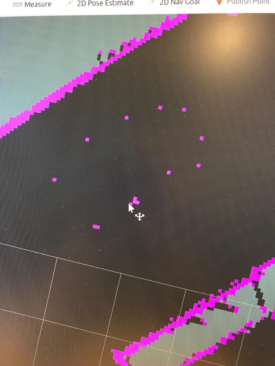
I am using a 2D lidar and sometimes, when I do the mapping, thin objects (like char legs) are detected as small dots on a map, like here:
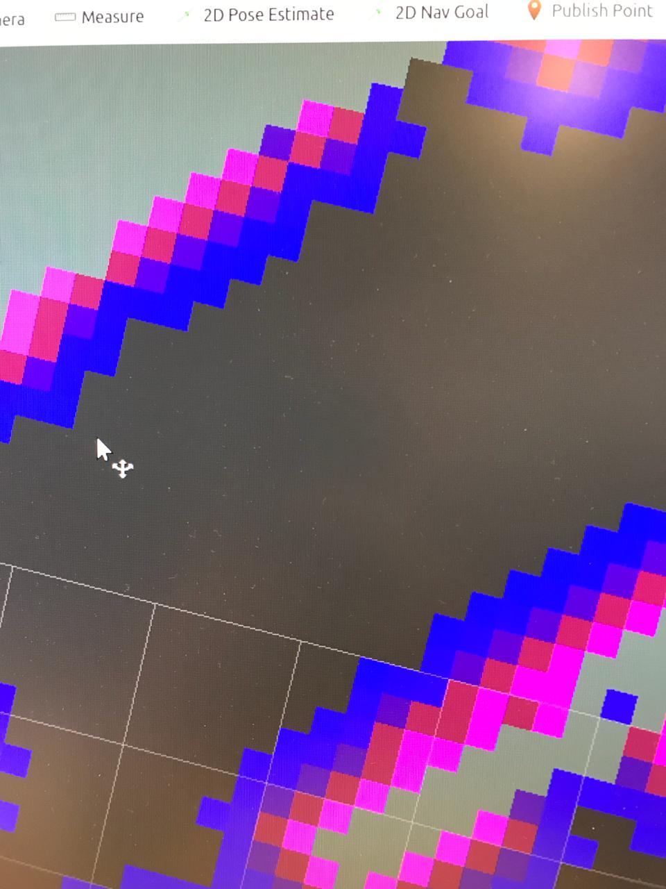
Now when I visualise the global costmap (which is used for a global planner) I get this map (exactly the same spot but now, the small objects are disappeared):
Can I include them in a costmap? As I want to create an inflation layer around them so the planner will not go through between those dots as they are chairs.

It sounds a bit odd that the inflation layer of the costmap is somehow erasing information from the map given and I have never seen that happening. I have the feeling that the resolutions are different between the maps, maybe there is some downscaling process that loses the desired information?
@juanlu it seems that there is a different resolution. How can I check it?
The metadata of the maps contains a field to indicate the resolution. If you open a map in rviz and look at its parameters in the "Displays" bar you can compare the resolutions of them both.