Hi there, this is a quite common task that is solved with the ROS Navigation Stack ( http://wiki.ros.org/navigation )
You can install it like this:
sudo apt-get install ros-indigo-navigation
assuming you have Ros Indigo installed, if you have Kinetic, just change it to kinetic.
Since you have a Kinect XBOX you also want to look into the Turtlebot navigation package ( http://wiki.ros.org/turtlebot_navigation )
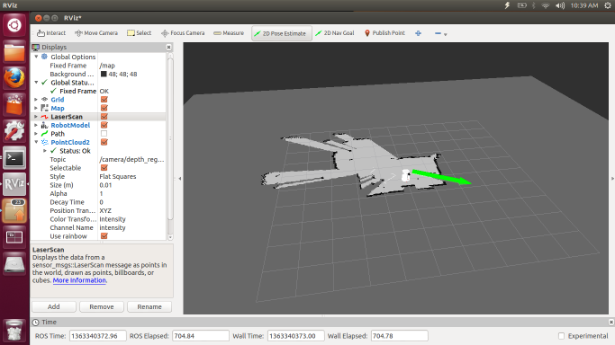
You'll end up with something looking like this:
But for that t happen you need to convert your pointcloud to a laserscan, good luck for you there is a package for that ;)
Check it here: http://wiki.ros.org/pointcloud_to_las...
Afterwards, you use the navigation stack and create your map with the laser scan, it'll be as easy as publishing a 2D Nav Goal for your robot to navigate. Good luck!


