Hi rozoalex,
You can find an overview of how the ROS navigation stack works here: http://wiki.ros.org/nav_core?distro=l...
Details of the local planner here: http://wiki.ros.org/base_local_planne...
Details of the global planner here: http://wiki.ros.org/global_planner?di...
This is the basic scheme:
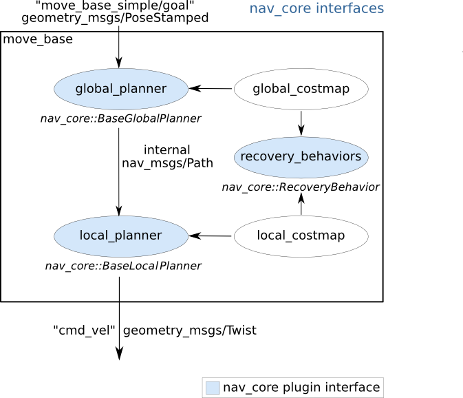
As you can see, both the local planner and the global planner use a costmap (a 2D o 3D representation of free/occupied space) constructed using sensor information.
If you want to add information from new sensors for the local costmap to consider you should do so by adding new layers to the local costmap. The layer type will depend on the sensor type. You should check the tutorials and documentation of the costmap_2d package.
I hope this helps

