ROS Resources: Documentation | Support | Discussion Forum | Index | Service Status | ros @ Robotics Stack Exchange
Ask Your Question
0

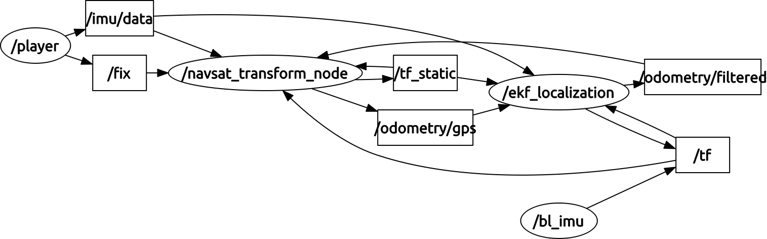
navsat robot_localization

asked 2015-07-27 03:06:11 -0500

Porti77 gravatar image

updated 2015-07-28 08:28:46 -0500

In Navasat_transform_node have a question about when the node receives a position becomes GPS latitude and longitude, UTM this format is x, and an identifier of area and band, for example Spain 29T, 30T and 31T, what happens when we change area or band ? X and Y incrise continue or start again?

Edit1: I have other problem, i download the last version for indigo and the ekf not publish the tf between base_link and odom like the other versions. Whats happen? image description

image description

image description

edit retag flag offensive close merge delete

Comments

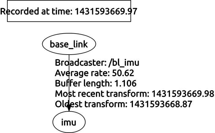
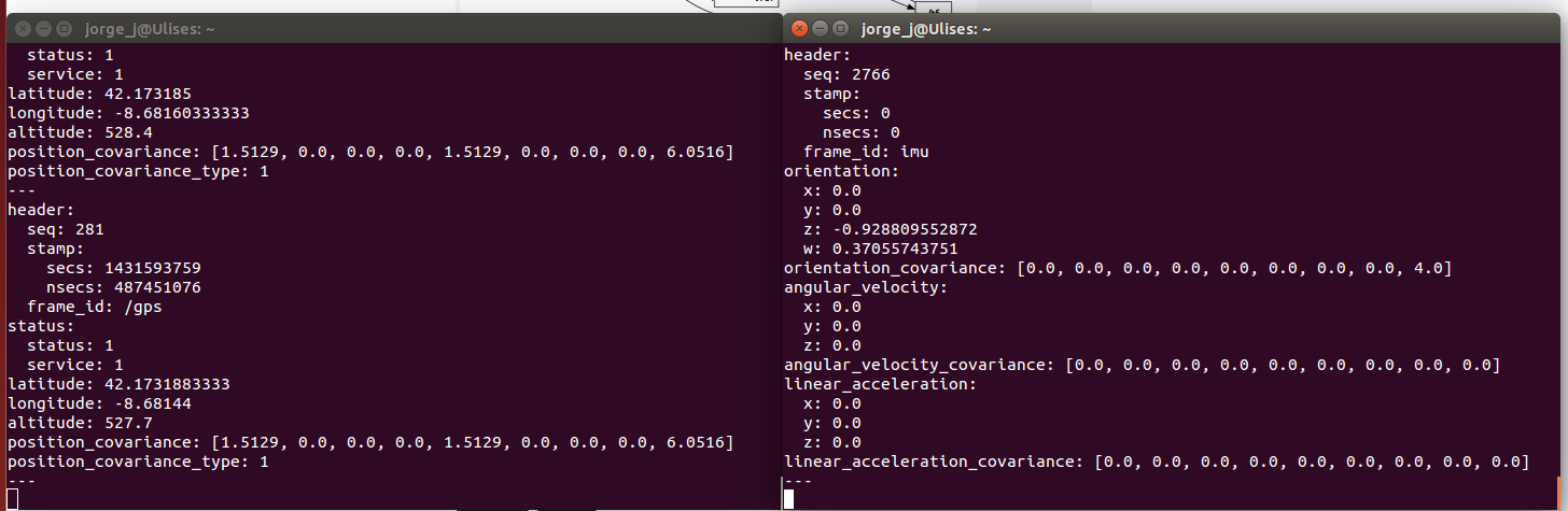
Your IMU message appears to have 0 time stamps. That won't work. Fix that, and if your issue isn't resolved, please post a new question.

Tom Moore gravatar image Tom Moore  ( 2015-07-28 08:43:44 -0500 )edit

1 Answer

Sort by ยป oldest newest most voted
0

answered 2015-07-27 08:10:21 -0500

Tom Moore gravatar image

I do believe that situation may cause trouble, so I've added an issue to the tracker and will update this answer when the fix is complete. While I can generate a made-up bag file with the right GPS coordinates to test this situation, if you happen to have one that you can share, I'd like to use it.

edit flag offensive delete link more

Comments

ok! I will generate a rosbag with this situation.

Porti77 gravatar image Porti77  ( 2015-07-28 07:55:50 -0500 )edit

That will be very helpful, thank you.

Tom Moore gravatar image Tom Moore  ( 2015-07-28 08:44:09 -0500 )edit

Question Tools

1 follower

Stats

Asked: 2015-07-27 03:06:11 -0500

Seen: 1,396 times

Last updated: Jul 28 '15