ROS Resources: Documentation | Support | Discussion Forum | Index | Service Status | ros @ Robotics Stack Exchange
Ask Your Question
1

Creating 3D grid map for amcl

asked 2014-01-26 16:38:05 -0500

FuerteNewbie gravatar image

updated 2014-01-28 17:07:33 -0500

ngrennan gravatar image

Hi guys,

I am doing a known mapping by using amcl, and I wish to improve my map by making it into 3d and view it inside rviz.

Here's my map image. (in .pgm)

image description

Is there any software in ubuntu that can draw it in 3D? Image file need to be compatible with yaml file in order to run map_server to be used by amcl. I am using fuerte.

Thank you so much.

Post update

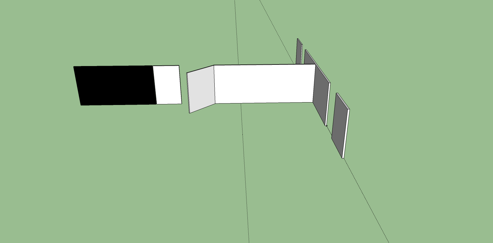
This is a 3D map I draw by using google SketchUp on window. I have exported it into Collada file.

How do I visualize it in rviz with respect to the /map frame?

image description

edit retag flag offensive close merge delete

1 Answer

Sort by » oldest newest most voted
0

answered 2014-01-27 05:25:27 -0500

updated 2014-01-29 04:45:48 -0500

Not sure there is anything like this readily available. What you could do (or what is the first quick way of doing it that comes to my mind ;) ) is write a small node that subscribes to your map and outputs a MarkerArray with a CubeList of all areas in the map that are occupied, so you have one scaled cube per occupied grid cell.

/edit: As you already have a 3D object representation of your environment, things are much easier. I recommend making your COLLADA file part of a ROS package and then following the instructions for publishing your mesh as a Marker here.

edit flag offensive delete link more

Comments

I have exported a .dae file from google SketchUp 8, how do I make use of urdf to visualize it on rviz?

FuerteNewbie gravatar image FuerteNewbie  ( 2014-01-27 13:32:07 -0500 )edit

See updated answer.

Stefan Kohlbrecher gravatar image Stefan Kohlbrecher  ( 2014-01-29 04:46:06 -0500 )edit

Question Tools

1 follower

Stats

Asked: 2014-01-26 16:38:05 -0500

Seen: 1,022 times

Last updated: Jan 29 '14